In the month since I published the first half of this blog piece we have lived for a while in a holiday flat in Teignmouth, completed our house purchase a week earlier than expected, spent several days and many car trips moving things we’d stored in the flat to our new home, taken delivery of all our old stuff, most of which is still sitting in boxes waiting for new furniture (some of which, thanks to the pandemic, won’t be arriving until next February, but much of it will be turning up two days from now) and spent literally hours on the phone trying to get utility companies to move, cancel or set up accounts. (But mostly the hours were spent just waiting for them to answer the phone.) A certain gas company which shall remain nameless has a neat trick up its sleeve for the unwary. New customers call them and after about 10 minutes of recorded information you are told not to bother them in these difficult times unless there is an emergency. Instead you are told you can do anything you might conceivably want to do online. So you go online and after several minutes you get ‘no you can’t do this online, you need to speak to us on…’ and it’s the same number you began with. This sort of stuff happens a lot when you are moving house right now, and while it’s to an extent understandable it’s also a wee bit stressful. Anyway, I digress. But right now, on a Tuesday evening in mid November, I have found some time to write
Beyond the exit from Holloway Lane a path ahead skirts around Haldon Wood, bends right then left, and becomes much wider as it descends to some thatched buildings near (according to my OS map) Haywood Common, then bends and descends further to a small bridge over a stream near Haydon. I’m often struck by the fact that places such as this are much, much nearer to me than the moor and most of the South Devon coastal towns, but not only have I never visited them, but I didn’t even know they exist!

I didn’t so much sit as perch on the fence over the stream and ate some baked cheese and onion crisps (best snack ever – no argument because my 3 year old grandson agrees) and a wilted banana, then wondered if my legs were up to the inevitable walk back up to the Haldon Hills where I’d started. I didn’t rest for long just in case, had a slurp of water and turned left at the next minor road, passing Lower Thornton Farm and looked for a sharp bend uphill. Here was one of those (very) minor Devon lanes-turned-roads that strike panic into a great many visitors who find themselves driving along them, wondering how a road can be not quite wide enough for one vehicle, never mind two..


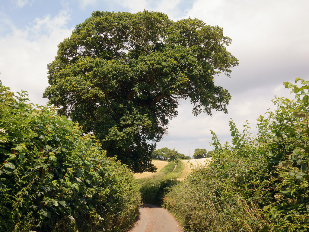
At the top of the road/lane there is an opportunity to look back and savour some of the route so far with a simply gorgeous view of a sleepy, unspoiled Devon landscape. This photograph was taken from the crossing of two minor roads, with not a vehicle or person anywhere in sight.
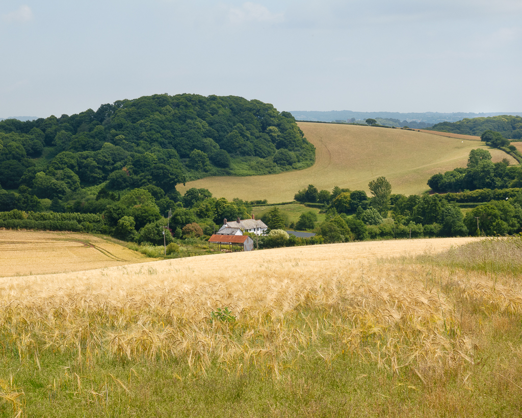
I pulled myself away, finally, and looked ahead. Somewhere beyond the undulations was the idyllic little village of Kenn, which lies in a deep valley hidden beneath the roaring A38 dual carriageway. The road links Exeter and Plymouth and at this point – a notorious section known as Splatford Split – the road divides into two halves: the A38 continues on to Plymouth, and the newly-hatched A380 heads steeply uphill on its way to Torquay. The new road travels almost alongside what would be my return route to the car. I would not be walking to Kenn, but needed to find the point where my final green lane of the day begins.

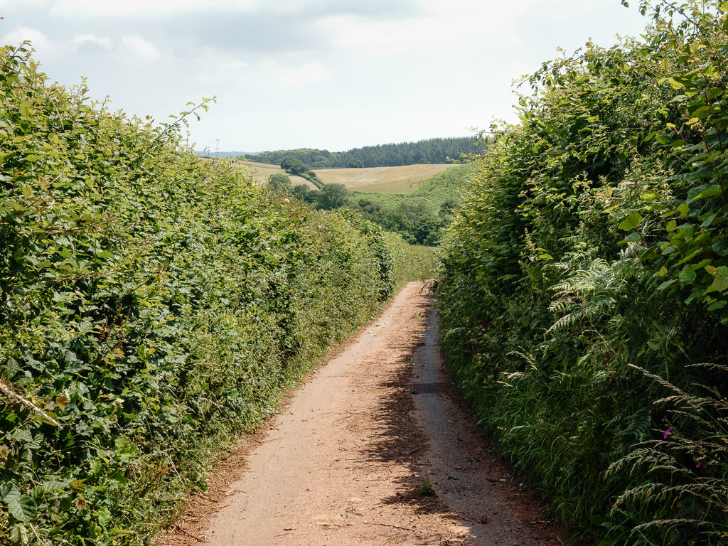
The beginning of the lane was marked not only with a public footpath sign, but also with a parked Open Reach van. I see these almost everywhere I go at the moment, usually in multiples, but there was hardly room for one here. St Andrews Lane is narrower than Holloway Lane, and rather steep in places. To me it does not have quite the appeal of Holloway Lane. It feels too ‘open’, somehow, the views around are more easily seen, there is no darkness, and I really do like that womb-like sense of enclosure and darkness I felt on Holloway Lane. I took far fewer photographs, even though it was far easier to jump onto the ‘walls’ and see the developing views as I got higher. The best view I saw was taken from the point below, but I’ll save that until the end.


I had heard that the top of the lane, being quite close to some of the Haldon Hills car parks, is used as a mountain bike trail, so was a little nervous as I neared the end of the lane, and saw some clear evidence that this was the case. In fact a little further up the track there was a notice from Forestry England confirming that this ‘Wild Bike Track’ is now closed, and listing a number of possible reasons! If I had known this a few minutes earlier I would have been a good deal more confident making my way to the end of the lane!

And suddenly the lane had ended and I was on a much wider forest track, similar to every other managed forestry track in the Haldon Hills. There was space, a million trees, no obvious vantage point and a straight route ahead, skirting near the road between Telegraph Hill and Mamhead. It was a relief, if anything, to be on an easy, wide track, no longer doubting I would complete the walk. The car lay directly ahead and when I reached it I took off my boots quickly, and stretched my legs in as many directions as possible to try and relieve some of the knee pain and loosen the muscles a little. I sat on the lip of the car boot, drank until there was no water left, and checked the screen on the back of my camera to see how the images looked that would make up my panoramic image of the view half way up St Andrews Lane.

This blog image is very small here on the website, and much too small if viewed on a phone, but I do love the original, made from 7 stitched photographs. It will blow up into a very large, detailed image. In the far distance Exeter is clearly visible and in the middle distance, right of centre, is the village of Kennford; on the far right is Kenn, with its distinctive village church, and beyond it, a patchwork of fields. Left of centre is Splatford Split, and I can see lorries at the bottom of the punishing Telegraph Hill. This is a perspective I hadn’t guessed would be visible of an area in the middle distance that I have to travel along very frequently. I see it here for the first time in the full context of the landscape all around. I can see how it all fits, and how, at least from this vantage point, this exquisite landscape still holds on despite all modern developments. If you want to see it, hopefully for a long time yet, these green lanes will more than repay your efforts. Best to have healthy knees though.


Leave a comment